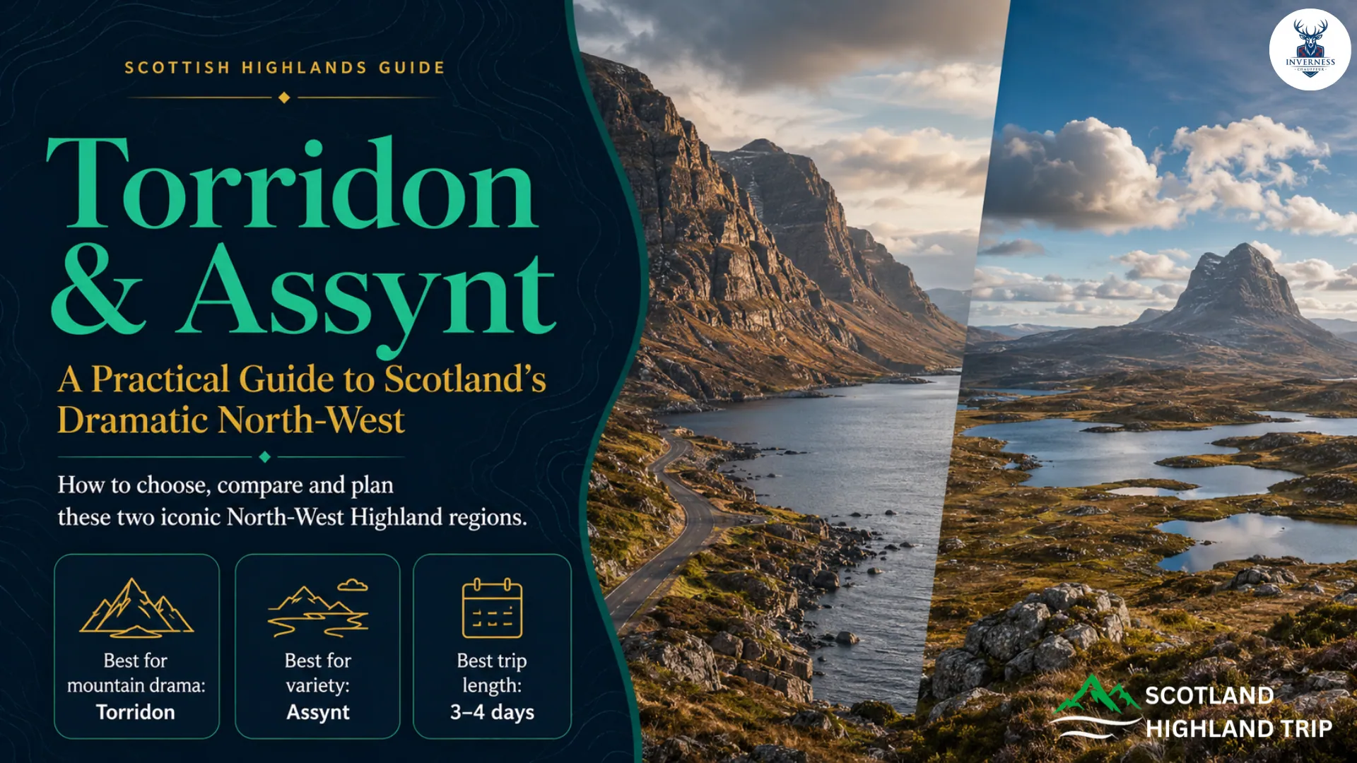
On the A896 through Glen Torridon, the mountains stand close to the road. Liathach and Beinn Eighe rise like walls above a narrow corridor of rock, river and moor. Travel north into Assynt and the composition changes. The sky becomes wider, lochans spread across low, ancient ground, and mountains such as Suilven and Quinag appear as separate shapes rather than one continuous range.
Both areas deliver exceptional North West Highland scenery, but they are not interchangeable. Torridon is the stronger choice for concentrated mountain drama and a shorter visit from Inverness. Assynt is better for a varied road trip mixing isolated peaks, geology, beaches, lochs and coastal settlements.
The important planning point is simple: do not treat Torridon and Assynt as two quick stops on one sightseeing day. A route planner may place central Torridon and Lochinver roughly 90 road miles apart, but single-track sections, passing traffic, weather and worthwhile stops turn the transfer into a substantial part of the day.
Give each area at least one proper day. Three to four days is a much better combined visit.
Jump to Section
Torridon and Assynt: The Quick Planning Answer
| Planning question | Best answer |
| Best for dramatic mountain glens | Torridon |
| Best for isolated peaks, geology and coast | Assynt |
| Best for a first day trip from Inverness | Torridon |
| Best for varied scenic driving over several days | Assynt |
| Can non-hikers enjoy them? | Yes—both have road-accessible scenery and low-level options |
| Minimum sensible time for both | Two full sightseeing days plus transfer time |
| Better combined visit | Three to four days |
| Best broad period | Late April to June or September, without any guarantee of settled weather |
| Main warning | Distances are slow, facilities are dispersed and many roads are single-track |
If you have only one day, choose one region. From Inverness, choose Torridon. From Ullapool, Lochinver or Kylesku, choose Assynt.
Where Are Torridon and Assynt?
Torridon is in Wester Ross on Scotland’s west coast. The name refers both to the village at the head of Loch Torridon and to the surrounding mountain area.
For most visitors, the useful road-trip triangle is Kinlochewe, Torridon and Shieldaig. Inverness is the nearest major transport hub.
Assynt lies farther north in south-west Sutherland. Lochinver is its principal service village, while Loch Assynt, Inchnadamph, Knockan Crag and Kylesku form useful points around its eastern and northern sides.
Assynt begins north of Ullapool in practical road-trip terms, although the cultural and geographical boundaries are more nuanced than a visitor map suggests.
The two areas are connected through the wider North West Highlands road network. There is no fast direct road that removes the coast, mountains or slow sections from the journey. Combining them rewards travellers who measure their itinerary in days rather than mileage.
Why Torridon and Assynt Do Not Look the Same
The difference begins with rock and erosion.
At Torridon, thick Torridonian sandstone forms high, terraced mountains above a base of much older Lewisian gneiss. The National Trust for Scotland dates the sandstone on its Torridon estate to about 750 million years and the underlying gneiss to more than 2.6 billion years.
Glacial erosion then cut deep troughs between the mountains. The result is a landscape that feels enclosed and vertical: steep ridges, corries, glens and sea lochs gathered into a relatively compact area. National Trust for Scotland explains Torridon’s geology.
Assynt exposes the relationship differently. The North West Highlands Geopark describes a low, glacially scoured foundation of Lewisian gneiss, dotted with small lochs and lochans. Erosion has left separate masses of Torridonian sandstone standing above it, including Suilven, Stac Pollaidh and Quinag.
This creates the region’s distinctive “island mountain” effect: each peak has space around it and changes shape as the road moves. The Geopark’s rock guide explains the underlying landscape.
This distinction changes the visitor experience:
- Torridon reveals itself through a glen. The mountains dominate at close range.
- Assynt reveals itself across distance. The same isolated peak may appear, disappear and return from a different angle.
Torridon tends to produce one powerful mountain composition after another. Assynt provides a broader mixture of mountain silhouettes, open moor, freshwater, coast, geology and settlement.
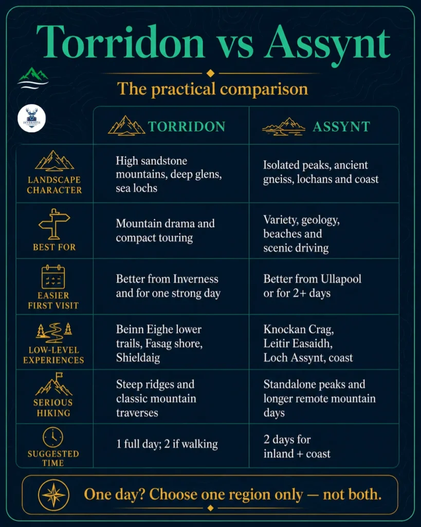
Torridon vs Assynt: The Practical Comparison
| Feature | Torridon | Assynt |
| Landscape character | High sandstone mountains concentrated around deep glens and sea lochs | Isolated sandstone peaks rising above ancient gneiss, lochans and coastal ground |
| Best for | Mountain scenery, compact touring and a strong first impression | Landscape variety, geology, beaches and repeated scenic drives |
| Scenic driving | Shorter, more concentrated and immediately dramatic | More extensive and varied, but requires more time |
| Low-level experiences | Beinn Eighe lower trails, Torridon village shore, loch and glen viewpoints | Knockan Crag, Little Assynt, Culag Woods, Loch Assynt, beaches and Kylesku |
| Serious hiking | Sustained, steep and sometimes exposed ridges | Long approaches, isolated mountains and steep or scrambling terrain |
| Coastal scenery | Sea lochs and villages, particularly around Shieldaig and Upper Loch Torridon | More beaches, rocky bays, headlands and the Kylesku area |
| Easier first visit | Better from Inverness and for one concentrated day | Better from Ullapool and for travellers with two or more days |
| Suggested time | One full day; two if walking | Two days for a useful combination of inland and coastal experiences |
What to See and Do in Torridon
Drive through Glen Torridon
The A896 between Kinlochewe and Shieldaig is the essential introduction. Approaching from Kinlochewe, the road enters the glen beneath Beinn Eighe and Liathach before reaching the head of Loch Torridon.
This is a scenic drive, but it is not a road on which to improvise parking. Use signed car parks and proper lay-bys. Do not stop in passing places, at gateways or on soft verges merely because a photograph appears.
The drive works in mixed weather because low cloud can emphasise the scale of the glen, but the highest ridges may disappear completely. If the view is your priority, keep flexibility in the day rather than committing to one fixed photography stop.
Classification: Scenic drive with roadside views. No hike required.
Explore Beinn Eighe at low level
Beinn Eighe and Loch Maree Islands National Nature Reserve gives non-climbers the best structured introduction to the Torridon landscape. Established in 1951 as the UK’s first National Nature Reserve, it extends from old pinewood to mountain ridges.
Several waymarked routes are listed by NatureScot.
Near the visitor centre outside Kinlochewe, the Pinecone trail and path towards the village have flat surfaces and low gradients. The longer Buzzard trail reaches more open ground and wider mountain views.
On the Loch Maree side, the woodland trail explores old pinewood. The separate mountain trail climbs much higher and should not be confused with an easy forest stroll.
This is Torridon’s most useful stop when:
- Cloud hides the high summits.
- Group members have different walking abilities.
- You want interpretation rather than only a roadside photograph.
- A serious mountain route would be inappropriate.
Classification: Visitor facilities and waymarked low-level trails, plus a separate strenuous mountain trail.
Walk around Torridon village
At Fasag, the village at the head of Loch Torridon, a shore path leads towards Am Ploc and continues around the bay.
The National Trust for Scotland also describes a grassy township path behind the community centre and a route towards its deer enclosure and small museum. See the Trust’s Torridon walking guidance.
This stop adds the human landscape that mountain-only guides frequently miss. Torridon is not simply a dramatic backdrop; it is a lived-in crofting and coastal community.
Use designated parking, respect homes and working land, and check current opening information for staffed facilities.
Classification: Short, low-level village and shore walking.
Add Shieldaig and Upper Loch Torridon
Shieldaig provides a useful contrast to Glen Torridon. The village looks across a sheltered sea loch and makes a sensible food or comfort stop when services are open.
The road around Upper Loch Torridon connects mountain scenery with smaller coastal settlements.
Travellers with more time can explore the minor road towards Inveralligin or Diabaig, but this is not essential for a first visit. The road becomes narrower and more committing than the central A896 experience.
Nervous drivers can see Torridon’s defining landscape without adding every minor peninsula road.
Classification: Village stop and scenic drive, with an optional narrow-road extension.
Serious walking in Torridon
Torridon’s famous mountains are not extensions of its roadside sightseeing.
- Beinn Alligin: The National Trust for Scotland classifies the full traverse as difficult: approximately 10.5km, seven to eight hours and 1,180m of ascent, with scrambling on the Horns. Check the current route description.
- Liathach: Walkhighlands describes a very steep 11.5km traverse taking approximately eight to ten hours, with scrambling, awkward boulders and exposed alternatives. See the Liathach route warning.
- Coire Mhic Fhearchair: This reaches Beinn Eighe’s Triple Buttresses without completing a summit traverse, but it remains a long, rough mountain walk rather than a quick lochside stop.
These routes require appropriate fitness, navigation, equipment and weather conditions. Winter snow or ice transforms them into mountaineering objectives.
If your group lacks the relevant experience, use a qualified guide or choose a low-level route.
What to See and Do in Assynt
Understand the landscape at Knockan Crag
Knockan Crag is the best first stop for understanding why Assynt looks different. Its exposed Moine Thrust helped geologists resolve a major nineteenth-century debate about how older rocks could lie above younger ones.
NatureScot provides several levels of visit:
- A short route from the car park to the Rock Room, with a low-gradient ramp avoiding the steps.
- An easier Quarry Trail.
- The Thrust Trail.
- The steeper Crag Top Trail for wider views over Coigach and Assynt.
Check NatureScot’s current visitor guidance before travelling.
Knockan Crag remains worthwhile when summit cloud removes the famous mountain tops. Its rock exposures, interpretation, sculpture and lower trail do not depend on a perfect panoramic forecast.
Classification: Road-accessible geological site with options ranging from short accessible access to a steeper trail.
Follow Loch Assynt to Ardvreck Castle
The A837 follows the northern side of Loch Assynt, with changing views towards Quinag and the surrounding peaks.
Ardvreck Castle stands on a promontory near the eastern end of the loch. It gives the route a historical stop as well as another mountain composition.
The castle is an unstaffed ruin rather than a fully serviced attraction. The Highland Council began a ten-week parking improvement project in January 2026 after congestion and informal parking created road-safety concerns.
Check live access and use only the formal area rather than relying on an older blog’s parking instructions. See the Highland Council project notice.
Ground between the parking area and ruin can be wet or uneven. Visitors with limited mobility can still appreciate the setting from near the road and information area when conditions make the approach unsuitable.
Classification: Roadside historical stop with a short, potentially wet or uneven approach.
Use Lochinver as a practical stop
Lochinver is more useful than a photograph-and-leave itinerary suggests. It is Assynt’s principal service settlement, with food businesses, shops, a petrol station and other community services listed by Discover Assynt.
Opening days and hours can be limited or seasonal. Verify what you need rather than arriving with an empty tank and only one dining plan.
Culag Woods provides a short local walk with views over Lochinver and towards Suilven. The commonly used circuit is approximately 3km and takes around an hour, but its informal woodland paths can be rough or muddy. Walkhighlands describes the route.
Classification: Service village and short, rough-underfoot woodland walk.
Choose a genuine low-level walk
Assynt has one of the clearest North West Highland options for people seeking an easier constructed path.
The Leitir Easaidh trail at Little Assynt follows easy gradients to two lochs, shelters and viewpoints towards Quinag and Suilven. The main route is approximately 2.5km and is described as suitable for wheelchairs and prams. Check the Little Assynt route.
The Bone Caves near Inchnadamph are frequently described as a short walk, but “short” does not mean level. The 4.5km circuit includes rough, narrow and steep sections near the caves, while their interiors can be slippery. It normally takes 1.5 to two hours. See the Bone Caves route description.
These walks should not be grouped under one vague “easy” label:
- Leitir Easaidh: Constructed, low-gradient and genuinely accessible by Highland path standards.
- Bone Caves: Shorter than a mountain day, but rougher, steeper and more weather-dependent.
Add the Assynt coast
Achmelvich and Clachtoll demonstrate the coastal side of Assynt that Torridon cannot match in the same concentration.
White sand, rocky bays, crofting ground and views back towards the mountains create a completely different day from Loch Assynt and Knockan Crag.
Clachtoll can be paired with a short coastal walk to the Iron Age broch. The commonly described circuit is approximately 3km, using close-cropped grass, a bouldery shore section and minor road. Check the Clachtoll route.
These beaches are not guaranteed swimming stops. Atlantic weather, cold water, wind and seasonal parking pressure all affect the experience. Treat them as coast and landscape first.
Reaching this part of Assynt may involve narrow single-track roads. The B869 north of Lochinver is particularly twisting, with steep sections and tight bends.
The official NC500 site recommends a less challenging alternative using the A894 and A837 for drivers who do not want to tackle the B869. See the NC500 road guidance.
Classification: Road-accessible coast with optional short walks and challenging single-track driving on certain approaches.
Stop at Kylesku
Kylesku marks the northern edge of the core Assynt visit for many road-trippers. Its curving bridge and sea-loch setting create a more architectural and coastal composition than the inland mountain stops.
Use signed parking or viewpoint areas and allow for through traffic. The bridge is part of a working road, not a pedestrian photography platform.
Kylesku also works as a logical transition towards Scourie and the north-west coast when continuing the NC500.
Classification: Roadside viewpoint and journey break.
Serious walking in Assynt
Assynt’s mountains can appear approachable because many stand alone and are lower than Torridon’s Munros. That appearance is misleading.
- Stac Pollaidh: The standard ridge-and-circuit route is approximately 4.5km, with 510m of ascent, and normally takes two to four hours. The climb is steep. The ordinary route does not reach the true western summit, which requires high-level scrambling expertise. See the Stac Pollaidh distinction.
- Suilven: The standard Lochinver-side route is approximately 20km, seven to nine hours and 947m of ascent. It has a long approach followed by a very steep climb to the ridge. See the Suilven route.
- Quinag: The full three-Corbett traverse is a serious mountain day of approximately 14km and 7.5 to 8.5 hours. Shorter out-and-back options exist, but they still require mountain judgement.
Stac Pollaidh is not a casual viewpoint merely because its route is shorter. Suilven is not a quick climb because it appears close from Lochinver.
Match the route to the least experienced member of your group.
Can Non-Hikers Enjoy Torridon and Assynt?
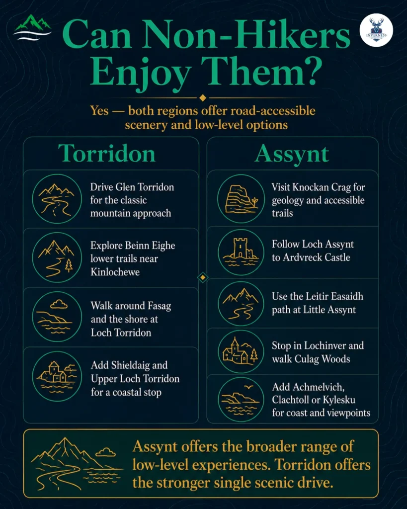
Yes. Neither region requires a summit to justify the journey.
In Torridon, non-hikers can drive Glen Torridon, use the lower Beinn Eighe trails, walk part of the Fasag shore and spend time around Shieldaig and Upper Loch Torridon.
In Assynt, they can visit Knockan Crag, follow Loch Assynt to Ardvreck Castle, use the Leitir Easaidh path, stop in Lochinver, explore a beach and continue to Kylesku.
Assynt has the stronger range of clearly different low-level experiences. Torridon has the stronger single drive.
If a group contains hillwalkers and non-walkers, Assynt is often easier to share: one person can tackle an appropriate route while others have geology, coast, woodland and village options. That plan still requires agreed timings, safe transport and a bad-weather alternative.
Which Area Should You Choose?
For a first-time visitor
Choose Torridon when you are based in Inverness and want the clearest return from one full day trip from Inverness. Its scenery becomes dramatic quickly, while the main road, village and nature reserve can form a coherent visit.
Choose Assynt if you are already in Ullapool or travelling the western NC500. It is more varied, but its principal experiences are spread over a wider area.
For photographers
Choose Torridon for close mountain walls, strong foreground-to-ridge compositions and rapidly changing light within a confined glen.
Choose Assynt for isolated silhouettes, reflections, beaches, geology and the ability to photograph one mountain from several directions.
Assynt offers more variety across several days. Torridon offers greater concentrated force.
For experienced walkers
Both deserve time. Torridon is the better choice for sustained, steep ridge days and classic Munro traverses.
Assynt is better for distinctive standalone mountains, long approaches and routes where the surrounding panorama matters as much as altitude.
For couples and relaxed travellers
Choose Torridon for a compact stay with one base, a scenic drive, short walks and time around the sea loch.
Choose Assynt if the shared pleasure is exploring by road and moving between geology, coast, village stops and moderate walks.
For road-trippers
Choose Assynt for the more varied multi-day driving experience.
Choose Torridon when your itinerary has less time and you want one defining west-coast section.
For visitors with one day
Do not attempt both.
- From Inverness: Torridon.
- From Ullapool: Southern and central Assynt.
- From Lochinver or Kylesku: Assynt.
For visitors with three or more days
Visit both. Give Torridon one full day, use at least half a day for the northward transfer with limited stops, and give Assynt one or two full days.
How Many Days Do You Need?
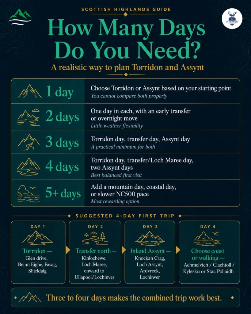
| Time available | Realistic plan | Main compromise |
| One day | Choose Torridon or Assynt according to your starting point | You cannot compare both properly |
| Two days | One day in each, with an early transfer or overnight move | Little weather flexibility and no serious mountain day |
| Three days | Torridon day, transfer day with selected stops, Assynt day | Coastal and inland Assynt still compete for time |
| Four days | Torridon day, transfer/Loch Maree day and two Assynt days | Best balanced first visit |
| Five days or more | Add a mountain day, coastal day or slower NC500 progression | Requires more accommodation planning |
One day is enough to understand one area, but not enough to experience both.
Two days can work if you are already in the North West Highlands. However, it offers no resilience when the first day is lost to heavy rain or low cloud.
A Realistic Three-to-Four-Day Plan
Day 1: Torridon
Drive through Glen Torridon, choose a lower Beinn Eighe trail, spend time at Fasag and finish around Upper Loch Torridon or Shieldaig.
Do not add a full mountain route to the same sightseeing day.
Day 2: Transfer north
Travel through Kinlochewe, Loch Maree and the west-coast road network towards Ullapool.
Choose one meaningful stop instead of constructing a list of ten lay-bys. Stay in Ullapool, Lochinver or another confirmed base suitable for the following day.
Day 3: Inland Assynt
Visit Knockan Crag, continue through the Loch Assynt and Inchnadamph area, add Ardvreck Castle if access and conditions permit, and finish in Lochinver or Little Assynt.
Day 4: Coast or walking
Choose one:
- Achmelvich, Clachtoll and a carefully planned coastal road.
- Little Assynt, Lochinver and Kylesku.
- Stac Pollaidh in suitable conditions for properly equipped walkers.
- A serious mountain day that replaces all sightseeing rather than being added to it.
The mountain day should go on the best forecast, not automatically on the date initially entered in the itinerary.
Best Time to Visit Torridon and Assynt
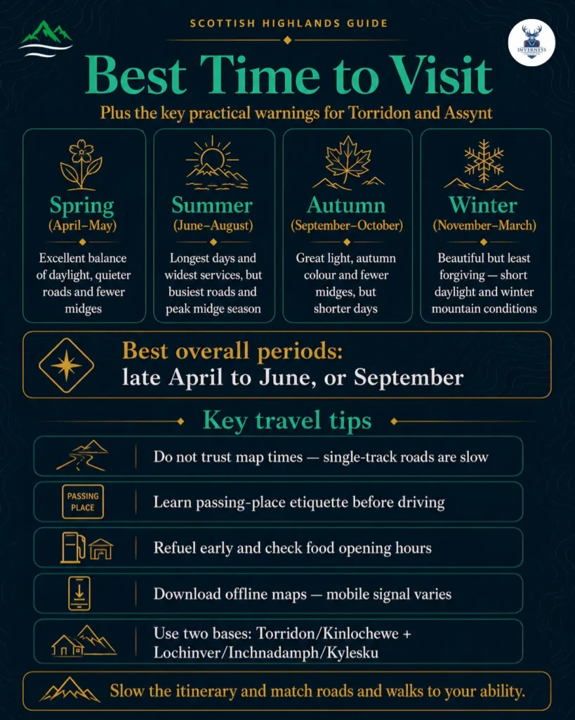
No month guarantees clear summits, dry roads or calm winds in the North West Highlands. For a season-by-season overview of the wider region, see our guide to the best time to visit the Scottish Highlands.
Spring: April and May
Spring often offers the best planning compromise. Daylight is increasing, roads and accommodation are generally less pressured than in high summer, and midge activity is usually below its mid-summer peak.
Higher routes can still retain snow or winter conditions. Some businesses may use reduced hours early in the season.
A warm day at sea level does not turn a high ridge into a summer walk.
Best for: Scenic driving, lower routes, photography and travellers who value quieter roads.
Summer: June to August
Summer provides the longest daylight and widest selection of open visitor businesses. It is also when popular car parks, beaches, short walks and NC500 sections can become busy.
VisitScotland describes the typical midge season as May to October, with peak activity in the middle of summer, particularly in the west Highlands during calm, overcast mornings and evenings. See the current midge guidance.
Long daylight should be used to reduce pressure, not to overfill the day. A late arrival at a mountain path is not made safe merely because sunset comes later.
Best for: Long touring days, wider service availability and travellers tied to school-holiday dates.
Autumn: September and October
September can combine useful daylight, developing autumn colour and declining midge activity as temperatures fall.
October brings stronger colour and lower-angle light, but daylight contracts quickly and seasonal opening hours become more significant.
Wind, rain and early wintry conditions can affect high ground. Build the itinerary around flexible low-level alternatives.
Best for: Photography, couples, quieter touring and experienced walkers capable of judging conditions.
Winter: November to March
Winter can produce snow, clear low-angle light and strong photography, but it is the least forgiving season for a casual road-and-hiking itinerary.
Daylight is short, ice or snow may affect roads, and many services operate limited hours.
On the mountains, snow, hard frost and ice require winter skills and equipment. Mountaineering Scotland emphasises that winter routes take longer and that knowledge is as important as carrying crampons or an ice axe. Review its winter guidance.
Best for: Experienced winter travellers, flexible photographers and conservative low-level itineraries.
Overall recommendation
For most first-time visitors, target late April through June or September.
Choose dates according to your priorities, book accommodation early and keep the daily plan flexible enough to respond to weather.
Driving, Fuel, Food and Mobile Coverage
Learn single-track etiquette before arriving
Road Safety Scotland gives the essential rule: when a passing place is on your left, pull into it. When it is on your right, wait opposite it so the approaching vehicle can use it.
Passing places also allow faster traffic behind to overtake. They are not parking spaces. Read the official single-track guidance, and avoid the other common Highland driving mistakes that catch first-time visitors out.
Also:
- Look ahead and anticipate where vehicles can meet.
- Be prepared to reverse to the nearest passing place.
- Slow down for blind bends, livestock, cyclists and walkers.
- Let local or faster traffic pass when it is safe.
- Avoid soft verges and drainage edges.
- Never drive while looking at the landscape.
Choose the road to match the driver
A public-road itinerary through Kinlochewe, Glen Torridon, Ullapool, Knockan Crag and Loch Assynt does not require an off-road vehicle.
Vehicle size and driver confidence matter more than SUV branding.
Nervous drivers should be selective about:
- The B869 coastal road north of Lochinver.
- Minor roads around Inverpolly and the Assynt coast.
- Optional Torridon roads towards smaller coastal settlements.
- Winter journeys affected by ice, snow, wind or poor visibility.
If the route feels like a driving test rather than a holiday, use the less challenging main-road alternative, reduce the loop or arrange an experienced driver.
Treat map times as minimums
Distances appear modest because maps do not show the effort of repeated bends, meeting traffic, waiting at passing places, slowing for livestock or stopping safely.
For realistic planning:
- Build each day around two or three main experiences.
- Add buffer time before meals and check-in.
- Do not schedule a fixed attraction immediately after a long single-track section.
- Never treat a non-stop route estimate as the length of a sightseeing day.
Fuel and food require planning
Kinlochewe has a garage, café and small shop listed by NatureScot. Lochinver has a petrol station and local services listed by Discover Assynt. Ullapool is the strongest service centre between the regions.
That does not mean every facility will be open whenever you arrive.
Check current days and hours, refuel before the gauge becomes urgent, carry water and retain a simple backup meal. Supporting community shops and cafés also helps maintain the services visitors depend on.
Mobile signal is not a safety plan
Coverage varies by network, topography and precise location.
Ofcom’s Scotland reporting continues to show a difference between coverage from at least one network and coverage from every operator, particularly across rural land. See Ofcom’s Connected Nations reporting.
Before leaving:
- Download offline maps.
- Save accommodation and emergency details.
- Tell someone your route when walking.
- Carry a power bank.
- Keep a paper map and compass for mountain routes.
- Do not assume a signal will be available at a trailhead or roadside breakdown.
What to Do When the Weather Closes In
Low cloud does not ruin the journey, but it should change your priorities.
In Torridon
Choose the lower Beinn Eighe trails, Torridon village and shore, the deer museum when open, Shieldaig and the drive through the glen.
Do not commit to Liathach, Beinn Alligin or another high route merely because conditions might improve.
In Assynt
Choose Knockan Crag’s interpretation and lower access, Loch Assynt, Ardvreck Castle when ground and parking conditions permit, Lochinver, Culag Woods or a coastal stop protected from the worst wind.
The famous isolated mountains may disappear in cloud, so use geology, history and community stops to carry the day.
In heavy rain or high wind, even a low-level plan may need to shrink. A waterfall, cave approach or exposed beach can become more hazardous—not more appealing—as conditions deteriorate.
Where to Stay
For Torridon
- Torridon/Fasag: Best for immediate access to the loch, village and central mountain scenery.
- Shieldaig: Best for a coastal base and Upper Loch Torridon.
- Kinlochewe: Best for Beinn Eighe, Loch Maree and connections back towards Inverness.
For Assynt
- Lochinver: Best all-round base for services, Suilven-side access, Little Assynt and the coast.
- Inchnadamph: Best for walkers and the Loch Assynt, Bone Caves and inland area.
- Kylesku: Useful for northern Assynt and onward NC500 travel.
- Ullapool: Best as a well-serviced southern gateway, but not a replacement for staying in Assynt when you want several coastal and northern stops.
For both regions
Change base at least once.
One night around Torridon or Kinlochewe and two nights around Lochinver or wider Assynt produces less backtracking than using Inverness or Ullapool for every day.
Book early for summer and confirm dinner arrangements. Having a room does not guarantee a nearby late-evening restaurant.
How Torridon and Assynt Fit Into the NC500
Both regions belong to the west-coast section of the North Coast 500, but they should not be compressed into one high-mileage stage.
The official route is slightly over 500 miles and includes the Torridon, Loch Maree, Ullapool, Assynt and Kylesku corridor on its western side. See the official NC500 overview.
A sensible progression is:
- Applecross or Shieldaig into Torridon.
- Torridon and Loch Maree towards Ullapool.
- Ullapool to Knockan Crag, Loch Assynt and Lochinver.
- Lochinver and the Assynt coast towards Kylesku.
Some named places require detours or optional minor roads. Achmelvich is not a reason to park irresponsibly or force an unsuitable vehicle through a route.
Stac Pollaidh is a separate outing south-west of the main inland road. Suilven is a full walking day from the Lochinver side.
If your NC500 plan allows only one night between Applecross and Kylesku, the schedule—not the landscape—is the problem. Add a night or remove stops.
Travel Responsibly
Torridon and Assynt are remote by Scottish tourism standards, but neither is empty or undiscovered.
Residents, crofters, emergency services, delivery drivers and road workers use the same roads.
- Park only in formal areas or genuine lay-bys.
- Never occupy a passing place.
- Keep gates as you find them.
- Control dogs around livestock.
- Follow the Scottish Outdoor Access Code.
- Use toilets and legal waste-disposal facilities.
- Take litter away.
- Avoid widening paths on wet ground.
- Buy fuel, food and services locally where practical.
- Do not present wildlife sightings as guaranteed.
Popular locations such as Stac Pollaidh, Achmelvich and roadside castle stops can be busy in summer. Visiting early or outside peak periods may help, but no location should be promised as quiet.
Final Recommendation
Choose Torridon when you want the most concentrated mountain experience, have one full day from Inverness or prefer to explore from a compact base.
Choose Assynt when you want the broader road trip: isolated mountains, geological interpretation, beaches, lochs, historic ruins and several different low-level experiences.
Choose both when you have at least three days in the North West Highlands—and preferably four. Give Torridon its own day, treat the transfer as real travel time and allow Assynt at least one full inland or coastal day.
The mistake is not choosing the “wrong” region. It is moving so quickly that Torridon becomes one windscreen view and Assynt becomes one photograph of Suilven from the road.
Slow the itinerary, match the roads and walks to your ability, and each area will explain why the North West Highlands feel unlike Scotland’s better-known tourism centres.
FAQs
Is Torridon or Assynt better for a first visit?
Torridon is usually better for a first visit from Inverness because its principal mountain scenery, village and low-level reserve options fit one coherent day. Assynt is better from Ullapool or for travellers with two or more days who want geology, beaches, isolated peaks and wider scenic driving.
Can you visit Torridon and Assynt without hiking?
Yes. Torridon offers the Glen Torridon drive, lower Beinn Eighe trails, Fasag shore and Shieldaig. Assynt offers Knockan Crag, Loch Assynt, Ardvreck Castle, Lochinver, the accessible Leitir Easaidh path, beaches and Kylesku.
How many days do you need for Torridon and Assynt?
Allow at least three days: one for Torridon, part of one for the transfer and one for Assynt. Four days is better because it permits two different Assynt experiences or provides weather flexibility. With one day, choose only one region.
Are Torridon and Assynt on the NC500?
Both are part of the west-coast NC500 experience. The route travels through the Torridon and Loch Maree corridor before continuing via Ullapool into Assynt and towards Kylesku. Certain beaches, viewpoints and walking starts require detours.
What is the best time to visit Torridon and Assynt?
Late April to June and September offer the best broad balance of daylight, services and lower pressure than peak summer, although weather is never guaranteed. July and August have long days but more visitors and peak midge activity.
Is the drive suitable for nervous drivers?
Nervous drivers should avoid optional minor-road loops, particularly the B869 north of Lochinver, and use the less challenging A894/A837 alternative. The core routes can be driven cautiously, but they contain narrow, winding and single-track sections.
Where should you stay to explore both areas?
Use two bases. Stay around Torridon, Shieldaig or Kinlochewe for Torridon, then move to Lochinver, Inchnadamph or Kylesku for Assynt. Ullapool is a useful transition but causes backtracking if used for every Assynt day.
Are Torridon and Assynt busy in summer?
They remain less visited than Skye or Glencoe overall, but popular car parks, beaches, short walks and NC500 roads can be busy in summer. Stac Pollaidh, Achmelvich and major roadside stops should not be described as reliably quiet.
Which area has easier low-level experiences?
Assynt offers the broader selection, particularly Knockan Crag, Leitir Easaidh, Lochinver, Loch Assynt and the coast. Torridon’s lower Beinn Eighe trails and village shore are valuable, but the region’s identity is more concentrated around steep mountain scenery.

Emma is a solo traveler and freelance travel writer from New Zealand who spent three weeks exploring the Scottish Highlands. With a deep appreciation for history and landscapes, she booked a series of day tours and a private chauffeur journey with Scotland Highland Trip. From Loch Ness to the Cairngorms, she documented her experience through vivid blog posts and drone footage.